
Author’s Note: My brother Mike is scheduled to run the Boston Marathon this year. Due to the pandemic, a virtual race will replace the traditional, in-person race the week of Labor Day in September. Runners have seven days (to chose from) to run 26.2 miles using the official timing app to submit a qualifying finishing time. While there is no shortage of trails or neighborhoods to run 26.2 miles in Washington, DC (he lives there), the mid-Atlantic heat and humidity make the early September dates a punishing place to run. No support, no fans and no finish line celebration, including that must-have goodie bag stocked with calorie-rich snacks for recovery. Not ideal.
During a recent bike ride, it occured to me that a familiar paved path through a scenic and less populated area in a “cooler” latitude could be a better option. The all-too-familiar path will have seen the peak of the tourist season come to end. Additionally, the family can act as “support,” leap-frogging him at designated interchanges along the trail. It’s odd to read these words in the same sentence, but looks like my brother will be running the Boston Marathon along the Cape Cod Rail Trail.

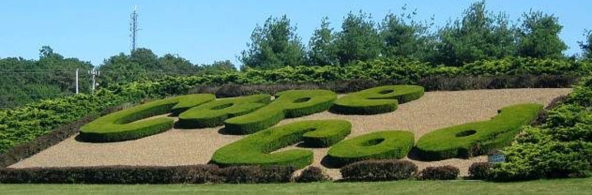
Expanded Cape Cod Rail Trail Better Than Ever
It may seem like bicycling on Cape Cod has been around forever; that thought would be correct. Bicycling soared in popularity in the late 1800s, which led to more paved roads (which also led to the shift from the railroad to the motor car for common transportation needs) across the peninsula that is Cape Cod. While it may seem like the Cape Cod Rail Trail (CCRT) has been around forever too, it is only nearing its 40th anniversary. Other paved bike trails on the Cape are actually older (ex: The Shining Sea Bikeway in Falmouth opened in 1975). In the CCRT’s case, an unofficial opening with little fanfare occurred in 1980, which gave way for a slightly more glamorous ribbon-cutting in September of 1981. Almost forty years later, that modest 7 mile paved recreational path from Brewster to Eastham has more than tripled to 25.5 miles from Yarmouth to Wellfleet, with ambitious expansion plans west to Falmouth and northeast to Provincetown. Wouldn’t that be something, one path connecting the entire peninsula!
The recreational trail would not be here if it was not for the railroads, and those origins are 170 years old. (My father, the family’s railroad and train laureate, should appreciate this divergence.) As I understand the complicated history of rail on Cape Cod…in 1848, the Cape Cod Branch Railroad laid the first set of tracks on Cape Cod, linking Middleboro (off-Cape) to Sandwich (upper-Cape). The line was extended to Wellfleet (outer-Cape) in 1873. Not surprisingly, all towns were not connected to this main line. To get in on the action, in 1886, the Chatham Railroad Company built 7 miles of new track from Harwich to Chatham. The Chatham Railroad Company eventually leased the railroad to the Old Colony Railroad, of which the spur rail trail gets its name. Indeed, the railroad transformed Cape Cod.

Tourism blossomed, refrigeration cars transported perishable products to and from, even baseball teams were able to play games in towns farther apart (Middleboro fielded a team that played in the Cape circuit in the late 1800s). While freight trains continued to run into the mid-1960s, passenger service shuttered in the late 1930s as roads and highways leading to and across Cape Cod were improved and the car became the preferred method of travel. Today, Cape Cod Central Railroad and the seasonal Cape Cod Flyer provide passenger service from Buzzard’s Bay and Boston, respectively, to Hyannis.
Back to the rails becoming trails. The first community to act was Harwich, where, in 1964, voters agreed to take the tracks going through the town by eminent domain for use as a bikeway upon failure of the line by track owners. The bikeway plan got another boost in 1967 when the Province Lands Bike Trail opened in Provincetown, followed by the opening of the Shining Sea Bikeway from North Falmouth to Woods Hole in 1975. Momentum grew to repurpose the failed Penn Central railway line through the mid, lower and outer cape, through Dennis, Harwich, Brewster, Orleans, and Eastham. In 1976, the Commonwealth of Massachusetts acquired part of the old New York-New Haven Railroad corridor and began construction of the rail trail connecting those mid-Cape and outer-Cape communities. The result was an eight-foot wide asphalt trail which would lead from Rt. 134 in Dennis to Locust Road in Eastham. As early as 1984, expansion plans were designed for the Harwich to Chatham spur trail. In 1995, another three miles were added from Locust Road to Lecount Hollow Road Wellfleet, bringing the trail to 22 miles in length.

The expansion of the CCRT continues, most notably with the recent opening of another 3.7 mile extension beginning at the trailhead off Higgins Crowell Road in South Yarmouth, connecting to the previous end point at Route 134 in South Dennis. Being based in Chatham, my bike riding mainly occurs along the Old Colony Rail Trail. That is, until a recent Sunday morning when I decided to check-out that new section of trail in Yarmouth and ended up pedaling just shy of 30 miles to Ocean View Drive in Wellfleet.. Indeed, the expanded CCRT is better than ever.
Below is a short overview of what you will find along the trail as well as a fun/interesting note about sections of the trail that cut through each town.
Amenities
Most of the amenities users will find next to the trail are located on the outer cape. Bike shops are scattered throughout the trail, but the majority of restaurants (restrooms) will be found beyond Nickerson State Park. If you are 21 or older, be on the look-out for the winery in Harwich!

Crossings
There are approximately 38 road road crossings, with about a dozen at major intersections. Bicyclists should stop and dismount before crossing, even though it is annoying especially when you have momentum on your side and wind at your back.

Natural environment
You will pass cranberry bogs, kettle ponds, wildlife sanctuaries, state park, beaches, unmarked and well worn dirt paths. If you have an unlimited amount of time, pack a for a side hike and a dip in the water.
Towns
Yarmouth
Most of the paved trail passes through lush, green forest then cuts through the Bayberry Hills Golf Course. A few high traffic road crossings bring you to Peter Homer Park, with the trail passing old railroad tracks, eventually paralleling the mid-Cape highway. Important note: Contrary to Google maps, the trail does not end at Dupont Avenue; it is a smooth connection from the Yarmouth trailhead off Higgins Crowell Road to Dennis.

Dennis
The former trailhead off Route 134 still is the home of mile marker “0” as well as the plaque providing a brief history of the trail, unlike my novel above. This section of the paved trail snakes around the industrial parks of Dennis. Notable features are limited major traffic crossings, peek-a-boo views of kettle ponds, and the first scent of salty pine. The Devil’s Purse Brewery is also a short detour off the trail.

Harwich
The Harwich section features acres upon acres of Harwich Conservation Land, a hidden wildlife sanctuary, the first bridge over Route 6, and the bicycle rotary, which takes you northeast to Brewster and on to Wellfleet or; east, to Harwich Center and onto Chatham. A notable highlight is the short detour to First Crush Winery.

Brewster
Arguably the most scenic stretch of the trail passes by a half dozen shimmering fresh water ponds that beg you to stop for a quick dip. The Brewster Conservation Trust also promotes multiple forested areas that are “preserved forever,” which will surely make you smile. The trail turns deeper into heavily wooded areas with many well-worn and not-so-worn dirt paths off the side. If you can muster additional miles, take a loop around the paved trails that weave through the 1,900 acre Nickerson State Park.

Orleans
The Orleans section passes over Route 6 again, before shifting into bustling Orleans Center, with restaurants, shopping and bike shops. One of the trailheads was an exchange point for the Ragnar Relay, which gave me a chuckle.

Eastham
The Eastham section has a more open feel, as the sky seems brighter and trail less crowded. The trail passes next to crowd-favorite Arnold’s Lobster and Clam Bar, known for fried clams, soft serve and mini golf! You can also take a longer detour (more like a side trip) to the Cape Cod National Seashore, Salt Pond Visitor Center, and Nauset Bike Trail by turning onto Locust Road, and then Salt Pond Road. You will have to cross Route 6 next to the former Lobster Shanty.

Wellfleet
The final section in Wellfleet is squeezed between Route 6 and the field of power lines. There is easy access to nearby restaurants, shops, campgrounds literally right off the trail. While the parking lot may signify the end of the trail, I would highly recommend continuing onto Lecount Hollow Road, up Ocean View Drive, all the way to Newcomb Hollow Beach. The peek-a-boo views at each dune overlook is worth the extra pedaling.

It took about 2 hours and 45 minutes to bike the trail from Yarmouth to Wellfleet with a couple short stops for water and pictures. Oh, and if you are planning to run 26.2 miles, continue into the Lecount Hollow Beach parking lot.
Enjoy the ride!